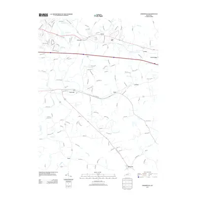
2013 Map of Fisherville
USGS Topo · Published 2013About this map
Fisherville sits at a crossroads of growth and tradition along the banks of Brush Run and Floyds Fork. This 2013 landscape reveals a suburban transition in eastern Jefferson County, where residential developments like those along Beckley Woods Dr and Lake Forest Dr meet established rural communities. The map highlights a series of small, historic nodes including Eastwood, Boston, and Routt, each maintaining its identity amidst a web of new suburban lanes and cul-de-sacs. To the north, Camp Dan Beard preserves a large tract of wooded terrain near the winding waters of Floyds Fork. Significant drainage patterns are defined by Pope Lick, Shakes Run, and Cane Run, which carve through the undulating topography. In the southeastern corner, the settlement of Wilsonville remains a distinct marker of the area's older settlement pattern, while Lincoln Ridge stands near the northern corridor of transportation and commerce.
Find a feature on this map
130 named features on this map. Tap any name to fly to it.
Don’t see what you’re looking for? This feature index may not catch every label — zoom into the map to look around manually.
Map Details
Editions of this 2013 Fisherville Map
This is the sole edition of this map. No revisions or reprints were ever made.
Other maps of this area

1905 · Prospect
USGS Topo · 1:62,500

1907 · Louisville
USGS Topo · 1:62,500

1912 · Prospect
USGS Topo · 1:62,500

1929 · Taylorsville
USGS Topo · 1:62,500

1932 · La Grange
USGS Topo · 1:62,500

1951 · Anchorage
USGS Topo · 1:24,000

1951 · Crestwood
USGS Topo · 1:24,000

1951 · Jeffersontown
USGS Topo · 1:24,000

1951 · Fisherville
USGS Topo · 1:24,000

1951 · Waterford
USGS Topo · 1:24,000