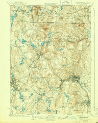
1935 Map of Fitchburg
USGS Topo · Published 1944About this map
The industrial corridor of Fitchburg Railroad and Cheshire Railroad serves as the backbone of this northern Massachusetts and New Hampshire border region. Large manufacturing and population centers like Fitchburg, Gardner, and Leominster show dense development, while smaller mill-driven communities such as Whitmanville and Wachusett Village are situated along the area's numerous brooks and reservoirs. The landscape is heavily defined by its water resources, including Meeting House Pond and Lake Monomonac, which historically powered the local mills.
Find a feature on this map
147 named features on this map. Tap any name to fly to it.
Don’t see what you’re looking for? This feature index may not catch every label — zoom into the map to look around manually.
Map Details
Editions of this 1935 Fitchburg Map
3 editions found

Other maps of this area

1885 · Worcester
USGS Topo · 1:62,500

1886 · Worcester
USGS Topo · 1:62,500

1887 · Winchendon
USGS Topo · 1:62,500

1887 · Marlboro
USGS Topo · 1:62,500

1887 · Barre
USGS Topo · 1:62,500

1887 · Fitchburg
USGS Topo · 1:62,500

1889 · Marlboro
USGS Topo · 1:62,500

1889 · Fitchburg
USGS Topo · 1:62,500

1889 · Barre
USGS Topo · 1:62,500

1890 · Winchendon
USGS Topo · 1:62,500