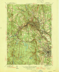
1946 Map of Fitchburg
USGS Topo · Published 1954About this map
Industrial nodes and steep topography define the northern Worcester County landscape during the mid-1940s. The city of Fitchburg serves as the dominant urban center, situated along the Nashua River and anchored by major institutions like the State Teachers College and Burbank Hospital. To the south, West Leominster appears as a growing community near the Leominster Hospital, with the Fitchburg Leominster Airport marking the outskirts.
Find a feature on this map
56 named features on this map. Tap any name to fly to it.
Don’t see what you’re looking for? This feature index may not catch every label — zoom into the map to look around manually.
Map Details
Editions of this 1946 Fitchburg Map
4 editions found
Other maps of this area

1885 · Worcester
USGS Topo · 1:62,500

1886 · Worcester
USGS Topo · 1:62,500

1887 · Marlboro
USGS Topo · 1:62,500

1887 · Fitchburg
USGS Topo · 1:62,500

1889 · Marlboro
USGS Topo · 1:62,500

1889 · Fitchburg
USGS Topo · 1:62,500

1892 · Worcester
USGS Topo · 1:62,500

1893 · Fitchburg
USGS Topo · 1:62,500

1893 · Groton
USGS Topo · 1:62,500

1896 · Marlboro
USGS Topo · 1:62,500