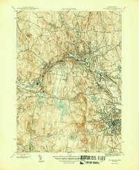
1946 Map of Fitchburg
USGS Topo · Published 1946About this map
The Nashua River valley serves as the industrial and transportation corridor for Fitchburg and Leominster in the mid-1940s. Heavy rail infrastructure, including the Boston and Maine Railroad and the New York New Haven and Hartford Railroad, underscores the region's manufacturing legacy, winding through the valley alongside satellite communities like West Fitchburg and Waites Corner. This 1946 edition reveals an intricate network of water management, with numerous reservoirs and ponds such as Notown Reservoir, Lovell Reservoir, and Sawmill Pond feeding the local industry and municipal needs.
Find a feature on this map
57 named features on this map. Tap any name to fly to it.
Don’t see what you’re looking for? This feature index may not catch every label — zoom into the map to look around manually.
Map Details
Editions of this 1946 Fitchburg Map
4 editions found
Other maps of this area

1885 · Worcester
USGS Topo · 1:62,500

1886 · Worcester
USGS Topo · 1:62,500

1887 · Marlboro
USGS Topo · 1:62,500

1887 · Fitchburg
USGS Topo · 1:62,500

1889 · Marlboro
USGS Topo · 1:62,500

1889 · Fitchburg
USGS Topo · 1:62,500

1892 · Worcester
USGS Topo · 1:62,500

1893 · Fitchburg
USGS Topo · 1:62,500

1893 · Groton
USGS Topo · 1:62,500

1896 · Marlboro
USGS Topo · 1:62,500