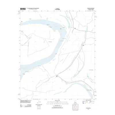
2012 Map of Fitler
USGS Topo · Published 2012About this map
The Mississippi River dominates this landscape on the border of Mississippi and Louisiana, creating a dynamic environment defined by shifting banks and river-adjacent settlements. The communities of Fitler and New Fitler are positioned near the eastern bank, connected by rural routes like N Derb Plantation Rd. The map illustrates the intensive engineering required to manage the river's path, featuring structures such as the Fitler Revetment, Cottonwood Revetment, and Point Lookout Dikes.
Find a feature on this map
30 named features on this map. Tap any name to fly to it.
Don’t see what you’re looking for? This feature index may not catch every label — zoom into the map to look around manually.
Map Details
Editions of this 2012 Fitler Map
This is the sole edition of this map. No revisions or reprints were ever made.
Other maps of this area

1909 · Lake Providence
USGS Topo · 1:24,000

1911 · Lake Providence
USGS Topo · 1:31,680

1939 · Onward
USGS Topo · 1:62,500

1939 · Lorenzen
USGS Topo · 1:62,500

1939 · Alsatia
USGS Topo · 1:62,500

1939 · Mayersville
USGS Topo · 1:62,500

1955 · Jackson
USGS Topo · 1:250,000

1961 · Jackson
USGS Topo · 1:250,000

1962 · Jackson
USGS Topo · 1:250,000

1963 · Onward
USGS Topo · 1:62,500