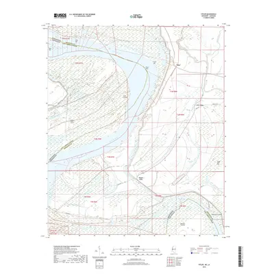
2018 Map of Fitler
USGS Topo · Published 2018About this map
The Mississippi River defines the western edge of this landscape, carving a complex series of bends and bars along the border of Issaquena County and East Carroll Parish. The intricate hydrography of the Mississippi Delta is evident in the numerous oxbows and secondary channels such as Fitler Lake, Concord Lake, and Transylvania Chute. These water features, alongside sediment deposits like Ajax Bar and Only Bar, illustrate the constant shifting of the river's course over time.
Find a feature on this map
44 named features on this map. Tap any name to fly to it.
Don’t see what you’re looking for? This feature index may not catch every label — zoom into the map to look around manually.
Map Details
Editions of this 2018 Fitler Map
This is the sole edition of this map. No revisions or reprints were ever made.
Other maps of this area

1909 · Lake Providence
USGS Topo · 1:24,000

1911 · Lake Providence
USGS Topo · 1:31,680

1939 · Onward
USGS Topo · 1:62,500

1939 · Lorenzen
USGS Topo · 1:62,500

1939 · Alsatia
USGS Topo · 1:62,500

1939 · Mayersville
USGS Topo · 1:62,500

1955 · Jackson
USGS Topo · 1:250,000

1961 · Jackson
USGS Topo · 1:250,000

1962 · Jackson
USGS Topo · 1:250,000

1963 · Onward
USGS Topo · 1:62,500