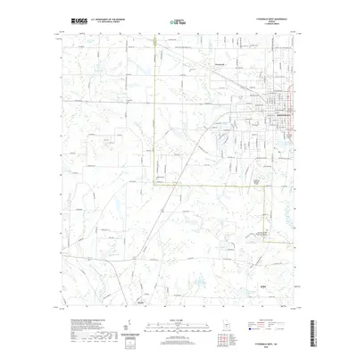
2020 Map of Fitzgerald West
USGS Topo · Published 2020About this map
Fitzgerald serves as a prominent hub on this South Georgia landscape, where the Ben Hill County Courthouse sits at the center of a dense urban grid. The surrounding terrain is defined by the convergence of the Irwin and Ben Hill county lines, which cut through a mosaic of agricultural fields and wetlands. Waterways like Willacoochee Creek, Reedy Creek, and Little Creek drain the area, feeding several significant reservoirs including Walker Lake, Taylor Lake, and County Lake.
Find a feature on this map
88 named features on this map. Tap any name to fly to it.
Don’t see what you’re looking for? This feature index may not catch every label — zoom into the map to look around manually.
Map Details
Editions of this 2020 Fitzgerald West Map
This is the sole edition of this map. No revisions or reprints were ever made.
Other maps of this area

1953 · Waycross
USGS Topo · 1:250,000

1958 · Waycross
USGS Topo · 1:250,000

1972 · Fitzgerald East
USGS Topo · 1:24,000

1972 · Ocilla East
USGS Topo · 1:24,000

1972 · Queensland
USGS Topo · 1:24,000

1973 · Ocilla West
USGS Topo · 1:24,000

1973 · Waterloo
USGS Topo · 1:24,000

1973 · Irwinville
USGS Topo · 1:24,000

1973 · Fitzgerald West
USGS Topo · 1:24,000

1974 · Rebecca
USGS Topo · 1:24,000