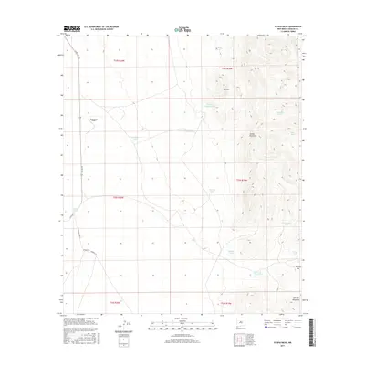
2017 Map of Fitzpatricks
USGS Topo · Published 2017About this map
Fitzpatricks and the surrounding high desert of Hidalgo County define this 2017 survey of the New Mexico borderlands. The landscape is characterized by a network of water management features essential for ranching in this arid environment, including Cornelius Tank, Tumblinson Tank, and the Red Hill Dirt Tank. These scattered resources support the grazing lands that roll toward the Animas Mountains in the east and the San Luis Mountains to the south. The local economy and transportation are anchored by Gray Ranch Airport and a grid of rural routes such as Co RD c001 and Fitzpatrick Camp Rd. High-altitude features like Birch Spring and the drainage at Ficks Draw indicate the rugged terrain near San Luis Pass, where the elevation shifts significantly from the desert floor. The map provides a clear picture of modern land use in a region where water sources and topographic barriers dictate the patterns of human settlement and movement.
Find a feature on this map
29 named features on this map. Tap any name to fly to it.
Don’t see what you’re looking for? This feature index may not catch every label — zoom into the map to look around manually.
Map Details
Editions of this 2017 Fitzpatricks Map
This is the sole edition of this map. No revisions or reprints were ever made.
Other maps of this area

1917 · Antelope Wells
USGS Topo · 1:62,500

1918 · Walnut Wells
USGS Topo · 1:62,500

1918 · Cienega Springs
USGS Topo · 1:62,500

1918 · Animas Peak
USGS Topo · 1:62,500

1919 · Antelope Wells
USGS Topo · 1:62,500

1920 · Animas Peak
USGS Topo · 1:62,500

1923 · Walnut Wells
USGS Topo · 1:62,500

1955 · Douglas
USGS Topo · 1:250,000

1959 · Douglas
USGS Topo · 1:250,000

1961 · Douglas
USGS Topo · 1:250,000