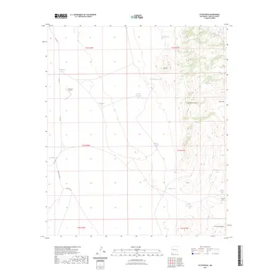
2023 Map of Fitzpatricks
USGS Topo · Published 2023About this map
Gray Ranch Airport serves as a lone modern landmark in this remote corner of Hidalgo County, where the desert flats meet the high country. The landscape is defined by the elevation gains of the Animas Mountains and the San Luis Mountains, separated by the natural corridor at San Luis Pass. This 2023 survey illustrates a region where water management is the primary human footprint, evidenced by a network of catchments such as Schoolhouse Tank, Cornelius Tank, and Rattlesnake Tank. These features, alongside ephemeral drainages like Birch Creek and Eicks Draw, provide essential infrastructure for ranching operations in a semi-arid environment. Transportation remains sparse, limited primarily to cattle routes and rural roads like Fitzpatrick Camp Rd and Co Rd C001.
Find a feature on this map
29 named features on this map. Tap any name to fly to it.
Don’t see what you’re looking for? This feature index may not catch every label — zoom into the map to look around manually.
Map Details
Editions of this 2023 Fitzpatricks Map
This is the sole edition of this map. No revisions or reprints were ever made.
Other maps of this area

1917 · Antelope Wells
USGS Topo · 1:62,500

1918 · Walnut Wells
USGS Topo · 1:62,500

1918 · Cienega Springs
USGS Topo · 1:62,500

1918 · Animas Peak
USGS Topo · 1:62,500

1919 · Antelope Wells
USGS Topo · 1:62,500

1920 · Animas Peak
USGS Topo · 1:62,500

1923 · Walnut Wells
USGS Topo · 1:62,500

1955 · Douglas
USGS Topo · 1:250,000

1959 · Douglas
USGS Topo · 1:250,000

1961 · Douglas
USGS Topo · 1:250,000