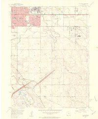
1957 Map of Fitzsimons
USGS Topo · Published 1958About this map
Fitzsimons Army Hospital and the surrounding Aurora street grid dominate the northern portion of this landscape during a period of significant military and suburban expansion. The map records a dense collection of mid-century community infrastructure, including St Thereses Sch, Kenton Sch, and the Hoffman Heights Educational Building. To the east, the Naval Air Station (Buckley Field) and portions of Lowry Air Force Base reflect the region's importance to national defense during the Cold War era.
Find a feature on this map
57 named features on this map. Tap any name to fly to it.
Don’t see what you’re looking for? This feature index may not catch every label — zoom into the map to look around manually.
Map Details
Editions of this 1957 Fitzsimons Map
2 editions found
Other maps of this area

1890 · East Denver
USGS Topo · 1:125,000

1935 · East Denver Nos. 3 and 4
USGS Topo · 1:48,000

1938 · Derby
USGS Topo · 1:24,000

1938 · Long Branch
USGS Topo · 1:24,000

1939 · Coal Creek
USGS Topo · 1:24,000

1940 · Englewood
USGS Topo · 1:31,680

1940 · Piney Creek
USGS Topo · 1:24,000

1940 · Derby
USGS Topo · 1:31,680

1941 · Long Branch
USGS Topo · 1:31,680

1941 · Fitzsimons
USGS Topo · 1:31,680