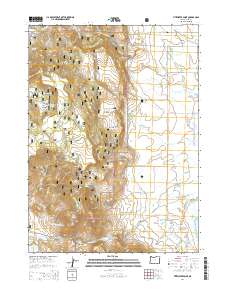
2014 Map of Fitzwater Point
USGS Topo · Published 2014About this map
Fremont National Forest dominates the high ground in this section of Lake County, where the landscape transitions from the wooded slopes of Fitzwater Point and Willow Creek Hills into the irrigated basins of the east. The water management system is a defining characteristic of the era, marked by the presence of the North Canal, South Canal, and East Canal which draw from significant impoundments like Drews Reservoir and Stover Reservoir. These canals support the agricultural lands along Westside Rd, while the higher elevations are dotted with vital water sources such as Miners Cabin Spring and Fitzwater Pass Spring. Evidence of early settlement and community remains at the W Side Cem, providing a focal point for genealogical research in this rural landscape. The topography is also shaped by named drainages like Drews Cr and McCoin Cr, which flow toward the edge of Goose Lake in the southeast.
Find a feature on this map
53 named features on this map. Tap any name to fly to it.
Don’t see what you’re looking for? This feature index may not catch every label — zoom into the map to look around manually.
Map Details
Editions of this 2014 Fitzwater Point Map
This is the sole edition of this map. No revisions or reprints were ever made.
Other maps of this area

1886 · Alturas
USGS Topo · 1:250,000

1892 · Alturas
USGS Topo · 1:250,000

1954 · Alturas
USGS Topo · 1:250,000

1955 · Klamath Falls
USGS Topo · 1:250,000

1958 · Alturas
USGS Topo · 1:250,000

1958 · Klamath Falls
USGS Topo · 1:250,000

1962 · Alturas
USGS Topo · 1:250,000

1962 · Willow Ranch
USGS Topo · 1:62,500

1962 · South Mountain
USGS Topo · 1:62,500

1964 · Drews Reservoir
USGS Topo · 1:24,000