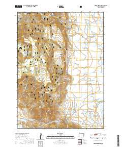
2020 Map of Fitzwater Point
USGS Topo · Published 2020About this map
Fremont National Forest dominates this landscape in southern Oregon, where the high country meets a complex network of agricultural irrigation. The western portion of the map is defined by the steep rises of Fitzwater Point and the Willow Creek Hills, punctuated by numerous water sources like Horseshoe Spring and Miners Cabin Spring. These uplands descend into more level terrain toward the east, where the land use transitions to managed water systems and cattle ranching. The eastern flats are marked by a series of canals, including the N Canal and E Canal, which feed into local catchments like Stover Reservoir and Renner Reservoir. This transition highlights the critical relationship between the timbered forest reserves and the water-dependent ranching operations in the arid basin. Near the northern boundary, the West Side Cem remains a localized historical landmark for the rural community gathered around the upper reaches of the Drews Reservoir area.
Find a feature on this map
52 named features on this map. Tap any name to fly to it.
Don’t see what you’re looking for? This feature index may not catch every label — zoom into the map to look around manually.
Map Details
Editions of this 2020 Fitzwater Point Map
This is the sole edition of this map. No revisions or reprints were ever made.
Other maps of this area

1886 · Alturas
USGS Topo · 1:250,000

1892 · Alturas
USGS Topo · 1:250,000

1954 · Alturas
USGS Topo · 1:250,000

1955 · Klamath Falls
USGS Topo · 1:250,000

1958 · Alturas
USGS Topo · 1:250,000

1958 · Klamath Falls
USGS Topo · 1:250,000

1962 · Alturas
USGS Topo · 1:250,000

1962 · Willow Ranch
USGS Topo · 1:62,500

1962 · South Mountain
USGS Topo · 1:62,500

1964 · Drews Reservoir
USGS Topo · 1:24,000