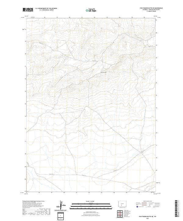
2021 Map of Five Fingers Butte NE
USGS Topo · Published 2021About this map
Cyclone Rim dominates the upper half of this high-desert landscape in Sweetwater County, forming a prominent topographical divide. The area is defined by a sparse network of access roads, including BLM Rd 3216 and BLM Rd 3214, which crisscross the Public Land Survey System sections of t26n r97w and t26n r96w. In the southwestern corner, the intermittent path of Red Cr provides a rare drainage feature in this otherwise arid terrain.
Find a feature on this map
9 named features on this map. Tap any name to fly to it.
Don’t see what you’re looking for? This feature index may not catch every label — zoom into the map to look around manually.
Map Details
Editions of this 2021 Five Fingers Butte NE Map
This is the sole edition of this map. No revisions or reprints were ever made.
Other maps of this area

1955 · Lander
USGS Topo · 1:250,000

1958 · Lander
USGS Topo · 1:250,000

1960 · Five Fingers Butte
USGS Topo · 1:62,500

1960 · Lost Creek Lake
USGS Topo · 1:62,500

1961 · Lander
USGS Topo · 1:250,000
1961 · Olson Springs
USGS Topo · 1:24,000
1961 · Picket Lake
USGS Topo · 1:24,000
1961 · Sulphur Bar Spring
USGS Topo · 1:24,000
1984 · South Pass
USGS Topo · 1:100,000
1988 · Lost Creek Lake
USGS Topo · 1:24,000