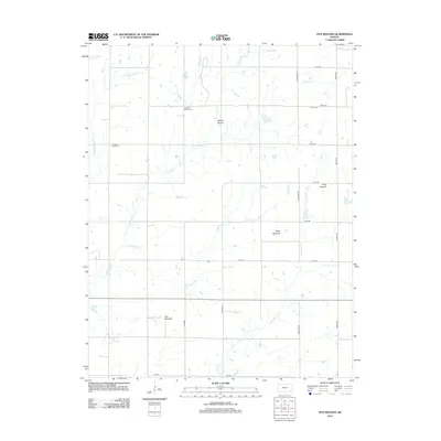
2012 Map of Five Mounds
USGS Topo · Published 2012About this map
Five Mounds and the other eponymous local rises define the topography of this corner of Neosho County. The map details a landscape carved by winding waterways including Big Cedar Cr, Pumpkin Cr, and Chetopa Cr, which snake through a structured grid of rural roads such as Wichita Rd and Anderson Rd. This 2012 survey illustrates the modern agricultural layout of the region, where family history is preserved at the Pleasant Valley Cem and Crane Cem. The distribution of these landmarks, alongside smaller features like Leonards Lake, reflects the sparse, persistent settlement pattern of the Kansas plains. Landforms like Dewey Mound and Long Mound provide notable elevation changes in an otherwise steadily draining river basin.
Find a feature on this map
25 named features on this map. Tap any name to fly to it.
Don’t see what you’re looking for? This feature index may not catch every label — zoom into the map to look around manually.
Map Details
Editions of this 2012 Five Mounds Map
This is the sole edition of this map. No revisions or reprints were ever made.
Other maps of this area

1886 · Fredonia
USGS Topo · 1:125,000

1886 · Iola
USGS Topo · 1:125,000

1886 · Independence
USGS Topo · 1:125,000

1886 · Parsons
USGS Topo · 1:125,000

1893 · Iola
USGS Topo · 1:125,000

1893 · Parsons
USGS Topo · 1:125,000

1894 · Fredonia
USGS Topo · 1:125,000

1894 · Independence
USGS Topo · 1:125,000

1904 · Iola
USGS Topo · 1:125,000

1905 · Independence
USGS Topo · 1:125,000