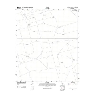
2012 Map of Five Wells Ranch SE
USGS Topo · Published 2012About this map
Magutex Oil Field anchors the northwestern corner of this landscape in Andrews County, where the industrial footprint of petroleum extraction meets a sprawling network of ranching infrastructure. The terrain is defined by a meticulous system of water management, evidenced by dozens of uniquely named windmills that supported livestock across the high plains. From the Sixteen Corner Windmill in the north to the Doodlebug Windmill in the south, these landmarks serve as vital navigational points in an area otherwise characterized by vast open spaces and limited natural surface water. The presence of Prairie Dog Flat Windmill and Lake Windmill suggests local depressions and seasonal catchment areas. Modern connectivity is provided by roads such as Ne 8301, which cut through the ranch lands to link these remote operations with the broader Texas oil and cattle economy.
Find a feature on this map
23 named features on this map. Tap any name to fly to it.
Don’t see what you’re looking for? This feature index may not catch every label — zoom into the map to look around manually.
Map Details
Editions of this 2012 Five Wells Ranch SE Map
This is the sole edition of this map. No revisions or reprints were ever made.
Other maps of this area

1954 · Hobbs
USGS Topo · 1:250,000

1958 · Hobbs
USGS Topo · 1:250,000

1966 · Mabee Ranch
USGS Topo · 1:24,000

1966 · Scharbauer Ranch
USGS Topo · 1:24,000

1966 · Bird Ranch
USGS Topo · 1:24,000

1968 · Baird Lake
USGS Topo · 1:24,000

1968 · Gardendale NW
USGS Topo · 1:24,000

1971 · Five Wells Ranch NW
USGS Topo · 1:24,000

1971 · Five Wells Ranch SE
USGS Topo · 1:24,000

1971 · Five Wells Ranch
USGS Topo · 1:24,000