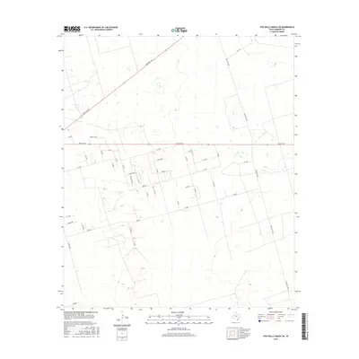
2016 Map of Five Wells Ranch SW
USGS Topo · Published 2016About this map
Quite Oaks sits at the heart of this Andrews County landscape, reflecting the modern rural residential development characteristic of West Texas in the early 21st century. The map reveals a structured grid of local access roads south of Ranch Rd 87, where residential lanes like Roadrunner, Meadowlark Ln, and Alva Ln intersect with numeric thoroughfares such as Se 1000 and Se 3000. This geometric layout contrasts with the wider regional connectivity provided by Ranch Rd 703 and Ranch Rd 1788. The terrain is marked by numerous depressions and subtle elevation changes, typical of the Llano Estacado, which dictate the placement of local loops like Hamrick Loop. For researchers, the map provides a precise record of the expansion of naming conventions and property divisions across the plains.
Find a feature on this map
40 named features on this map. Tap any name to fly to it.
Don’t see what you’re looking for? This feature index may not catch every label — zoom into the map to look around manually.
Map Details
Editions of this 2016 Five Wells Ranch SW Map
This is the sole edition of this map. No revisions or reprints were ever made.
Other maps of this area

1954 · Hobbs
USGS Topo · 1:250,000

1958 · Hobbs
USGS Topo · 1:250,000

1963 · Andrews
USGS Topo · 1:24,000

1968 · Baird Lake
USGS Topo · 1:24,000

1968 · Gardendale NW
USGS Topo · 1:24,000

1968 · Clabber Hill Ranch
USGS Topo · 1:24,000

1971 · Five Wells Ranch NW
USGS Topo · 1:24,000

1971 · Florey
USGS Topo · 1:24,000

1971 · Five Wells Ranch SE
USGS Topo · 1:24,000

1971 · Five Wells Ranch
USGS Topo · 1:24,000