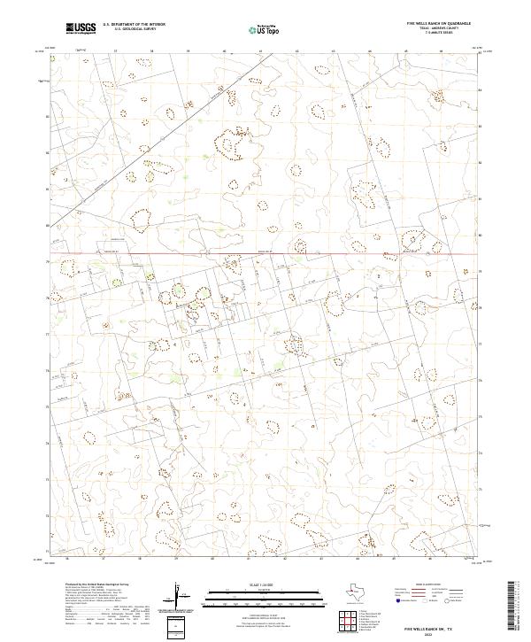
2022 Map of Five Wells Ranch SW
USGS Topo · Published 2022About this map
The expansive ranchlands of Andrews County, Texas, define the landscape of this 2022 survey. Dominated by a rigorous grid of ranch roads, the area is partitioned by Ranch Rd 87 and Ranch Rd 1788, which facilitate movement through a territory characterized by subtle elevation changes and local landmarks like Hamrick Loop. The high concentration of numbered rural roads, such as Se 1000 and Se 5000, suggests a modern landscape organized for oil and gas activity or large-scale agriculture, where traditional town centers are absent in favor of industrial and ranching access routes like Ranch Rd 703. For researchers of West Texas history, this map documents the contemporary footprint of development in the Permian Basin, showing the precise intersection of state-maintained ranch-to-market routes and the smaller, privately utilized tracks that crisscross the plains.
Find a feature on this map
43 named features on this map. Tap any name to fly to it.
Don’t see what you’re looking for? This feature index may not catch every label — zoom into the map to look around manually.
Map Details
Editions of this 2022 Five Wells Ranch SW Map
This is the sole edition of this map. No revisions or reprints were ever made.
Other maps of this area

1954 · Hobbs
USGS Topo · 1:250,000

1958 · Hobbs
USGS Topo · 1:250,000

1963 · Andrews
USGS Topo · 1:24,000

1968 · Baird Lake
USGS Topo · 1:24,000

1968 · Gardendale NW
USGS Topo · 1:24,000

1968 · Clabber Hill Ranch
USGS Topo · 1:24,000

1971 · Five Wells Ranch NW
USGS Topo · 1:24,000

1971 · Florey
USGS Topo · 1:24,000

1971 · Five Wells Ranch SE
USGS Topo · 1:24,000

1971 · Five Wells Ranch
USGS Topo · 1:24,000