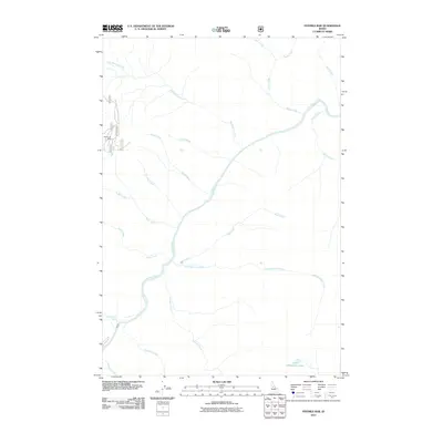
2011 Map of Fivemile Bar
USGS Topo · Published 2011About this map
Mammoth Mine stands as a notable landmark of industrial activity in this remote Idaho landscape, situated near Tepee Creek in the western reaches of the quadrangle. The terrain is defined by the winding course of the Salmon River, which draws in a complex network of tributaries including Big Blowout Creek, Jersey Creek, and No Man Creek. This 2011 survey captures the area's hydrology in detail, showing the remote Little Sheepeater Lake to the south and the reliable water source of Henry Moore Spring. Navigation through the steep drainages is largely dependent on the Natl Forest Develop Road 222F Rd, which provides access to the higher elevations near the mine. The map illustrates a wilderness shaped by its waterways, with Little Fivemile Creek and Fivemile Creek carving paths toward the central river valley.
Find a feature on this map
24 named features on this map. Tap any name to fly to it.
Don’t see what you’re looking for? This feature index may not catch every label — zoom into the map to look around manually.
Map Details
Editions of this 2011 Fivemile Bar Map
This is the sole edition of this map. No revisions or reprints were ever made.
Other maps of this area

1931 · Buffalo Hump
USGS Topo · 1:125,000

1934 · Buffalo Hump
USGS Topo · 1:125,000

1956 · Warren
USGS Topo · 1:62,500

1956 · Elk City
USGS Topo · 1:250,000

1960 · Elk City
USGS Topo · 1:250,000

1977 · Silver Spur Ridge
USGS Topo · 1:24,000

1978 · Mosquito Peak
USGS Topo · 1:24,000

1978 · Chicken Peak
USGS Topo · 1:24,000

1979 · Dixie
USGS Topo · 1:24,000

1979 · Fivemile Bar
USGS Topo · 1:24,000