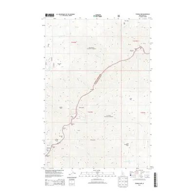
2013 Map of Fivemile Bar
USGS Topo · Published 2013About this map
Nez Perce National Forest and Payette National Forest meet along a river corridor defined by sandbars and remote outposts. These river bars, including Boise Bar, Painter Bar, and Fivemile Bar, represent the primary points of human activity in this vertical landscape. The map shows the infrastructure necessary for accessing these remote locations, such as the Mackay Bar Bridge and the Wilson Bar USFS Airport, which serves as a critical connection point for the backcountry. Away from the water, the terrain climbs toward peaks like Mammoth Mtn and Abrams Height, where the Blue Ridge Cabin and various campgrounds suggest a landscape utilized for forest management and seasonal shelter. The presence of Grizzly Gulch and Little Sheepeater Lake underscores the isolation of this Idaho County wilderness in the early twenty-first century.
Find a feature on this map
55 named features on this map. Tap any name to fly to it.
Don’t see what you’re looking for? This feature index may not catch every label — zoom into the map to look around manually.
Map Details
Editions of this 2013 Fivemile Bar Map
This is the sole edition of this map. No revisions or reprints were ever made.
Other maps of this area

1931 · Buffalo Hump
USGS Topo · 1:125,000

1934 · Buffalo Hump
USGS Topo · 1:125,000

1956 · Warren
USGS Topo · 1:62,500

1956 · Elk City
USGS Topo · 1:250,000

1960 · Elk City
USGS Topo · 1:250,000

1977 · Silver Spur Ridge
USGS Topo · 1:24,000

1978 · Mosquito Peak
USGS Topo · 1:24,000

1978 · Chicken Peak
USGS Topo · 1:24,000

1979 · Dixie
USGS Topo · 1:24,000

1979 · Fivemile Bar
USGS Topo · 1:24,000