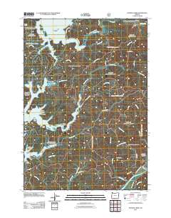
2011 Map of Fivemile Creek
USGS Topo · Published 2011About this map
Siltcoos Lake and Tahkenitch Lake dominate this coastal landscape, their irregular shorelines creating numerous points and arms such as Snare Point, Crabtree Point, and the Big Arm. The interior is characterized by a dense network of watercourses including Fivemile Creek and Fiddle Creek, which drain the timbered heights of Booth Ridge. This 2011 survey reveals the infrastructure of the Siuslaw National Forest, showing numerous forest development roads like Nat For Dev Rd 4811 and logging-related landmarks such as Booth Landing. Local history and genealogy interest is centered on the Independent Order of Odd Fellows Cemeteries located near the southern reaches of Siltcoos Lake. The topography shifts from the tidal influences of Hudson Slough and the Smith River in the south to the secluded Miles Canyon in the north, illustrating the diverse drainage patterns of the Oregon coast.
Find a feature on this map
53 named features on this map. Tap any name to fly to it.
Don’t see what you’re looking for? This feature index may not catch every label — zoom into the map to look around manually.
Map Details
Editions of this 2011 Fivemile Creek Map
This is the sole edition of this map. No revisions or reprints were ever made.
Other maps of this area

1919 · Earl
USGS Topo · 1:48,000

1920 · Siltcoos Lake
USGS Topo · 1:62,500

1923 · Reedsport
USGS Topo · 1:62,500

1941 · Siltcoos Lake
USGS Topo · 1:62,500

1942 · Siltcoos Lake
USGS Topo · 1:62,500

1942 · Reedsport
USGS Topo · 1:62,500

1943 · Goodwin Peak
USGS Topo · 1:62,500

1954 · Coos Bay
USGS Topo · 1:250,000

1955 · Scottsburg
USGS Topo · 1:62,500
1956 · Reedsport
USGS Topo · 1:62,500