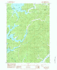
1984 Map of Fivemile Creek
USGS Topo · Published 1987About this map
Siuslaw National Forest encompasses this coastal Oregon landscape, where the complex shorelines of Siltcoos Lake and Tahkenitch Lake meet the Pacific corridor. This 1984 provisional map documents the transition between the Oregon Dunes Nat Recreation Area and the inland timberlands. The Southern Pacific rail line threads through the terrain, serving historical points such as Ada Station and several mapped locations of former activity including Booth (Site), Bass (Site), and Brenham (Site). These sites, alongside Fir Grove Cem, offer specific coordinates for researchers tracing the early logging and transport history of Douglas County. The intricate geography of the lake arms, such as Fivemile Arm and Bear Trap Arm, illustrates how the coastal forest was partitioned by water and ridge, creating a distinctive network of creeks like Fiddle Creek and Perkins Creek.
Find a feature on this map
58 named features on this map. Tap any name to fly to it.
Don’t see what you’re looking for? This feature index may not catch every label — zoom into the map to look around manually.
Map Details
Editions of this 1984 Fivemile Creek Map
This is the sole edition of this map. No revisions or reprints were ever made.
Other maps of this area

1919 · Earl
USGS Topo · 1:48,000

1920 · Siltcoos Lake
USGS Topo · 1:62,500

1923 · Reedsport
USGS Topo · 1:62,500

1941 · Siltcoos Lake
USGS Topo · 1:62,500

1942 · Siltcoos Lake
USGS Topo · 1:62,500

1942 · Reedsport
USGS Topo · 1:62,500

1943 · Goodwin Peak
USGS Topo · 1:62,500

1954 · Coos Bay
USGS Topo · 1:250,000

1955 · Scottsburg
USGS Topo · 1:62,500
1956 · Reedsport
USGS Topo · 1:62,500