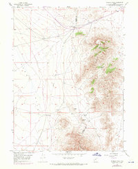
1949 Map of Fivemile Pass
USGS Topo · Published 1970About this map
Thorpe Hills and the eastern edge of Rush Valley dominate this high-desert landscape along the border of Tooele and Utah counties. Based on surveys from the 1940s with late-1960s updates, the map documents a transition from early industrial activity to modern navigation. The presence of an Old Railroad Grade and numerous prospects near Topliff reflect a history of mineral exploration and transport that once pulsed through these passes.
Find a feature on this map
13 named features on this map. Tap any name to fly to it.
Don’t see what you’re looking for? This feature index may not catch every label — zoom into the map to look around manually.
Map Details
Editions of this 1949 Fivemile Pass Map
2 editions found
Other maps of this area

1885 · Tooele Valley
USGS Topo · 1:250,000

1915 · Fairfield
USGS Topo · 1:62,500

1917 · Fairfield
USGS Topo · 1:62,500

1918 · Stockton
USGS Topo · 1:62,500

1947 · Fivemile Pass
USGS Topo · 1:62,500

1947 · Allens Ranch
USGS Topo · 1:24,000

1947 · Boulter Peak
USGS Topo · 1:24,000

1947 · Goshen Pass
USGS Topo · 1:24,000

1949 · Allens Ranch
USGS Topo · 1:24,000

1949 · Fivemile Pass
USGS Topo · 1:24,000