
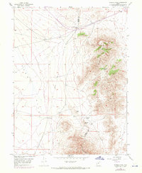
1949 Map of Fivemile Pass
USGS Topo · Published 1949About this map
The boundary between Tooele Co and Utah Co cuts through this high desert terrain, where the northern end of Rush Valley meets the rising slopes of the Thorpe Hills. The landscape is defined by its strategic passages, notably Fivemile Pass, Sevenmile Pass, and Tenmile Pass, which have historically dictated transportation routes through this part of the Great Basin. Transportation history is particularly evident here; while the Union Pacific line remains active in the north, a (Dismantled Railroad) branches south toward the settlement of Topliff, hinting at the area's waning mining or industrial activity in the late 1940s. Beyond the rail lines, the presence of an Airway Beacon and Topliff Hill serve as essential navigational landmarks for both ground and air travel across this arid expanse.
Find a feature on this map
12 named features on this map. Tap any name to fly to it.
Don’t see what you’re looking for? This feature index may not catch every label — zoom into the map to look around manually.
Map Details
Editions of this 1949 Fivemile Pass Map
2 editions found
Other maps of this area

1885 · Tooele Valley
USGS Topo · 1:250,000

1915 · Fairfield
USGS Topo · 1:62,500

1917 · Fairfield
USGS Topo · 1:62,500

1918 · Stockton
USGS Topo · 1:62,500

1947 · Fivemile Pass
USGS Topo · 1:62,500

1947 · Allens Ranch
USGS Topo · 1:24,000

1947 · Boulter Peak
USGS Topo · 1:24,000

1947 · Goshen Pass
USGS Topo · 1:24,000

1949 · Allens Ranch
USGS Topo · 1:24,000

1949 · Goshen Pass
USGS Topo · 1:24,000