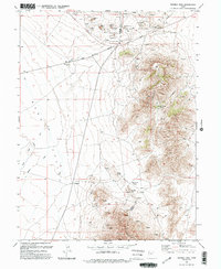
1993 Map of Fivemile Pass
USGS Topo · Published 1993About this map
The Pony Express and Overland Stage Route cuts through the northern landscape of this map, following a path through Fivemile Pass on the border of Tooele Co and Utah Co. This area is characterized by heavy industrial activity, as evidenced by a high concentration of Mines, Open Pit Mines, and multiple Prospects scattered across the high ground. To the south, the settlement of Topliff sits near Topliff Hill, marking a point of human habitation in a region otherwise dominated by resource extraction and rugged transit corridors. The hydrology of Rush Valley is represented by seasonal drainage through Sabie Creek and Boulter Creek, along with various man-made water features labeled as Ditch. The terrain transitions from these low basins up to distinctive elevations like Poker Knoll, Powder Knoll, and the passes at Sevenmile Pass and Tenmile Pass.
Find a feature on this map
33 named features on this map. Tap any name to fly to it.
Don’t see what you’re looking for? This feature index may not catch every label — zoom into the map to look around manually.
Map Details
Editions of this 1993 Fivemile Pass Map
2 editions found
Other maps of this area

1885 · Tooele Valley
USGS Topo · 1:250,000

1915 · Fairfield
USGS Topo · 1:62,500

1917 · Fairfield
USGS Topo · 1:62,500

1918 · Stockton
USGS Topo · 1:62,500

1947 · Fivemile Pass
USGS Topo · 1:62,500

1947 · Allens Ranch
USGS Topo · 1:24,000

1947 · Boulter Peak
USGS Topo · 1:24,000

1947 · Goshen Pass
USGS Topo · 1:24,000

1949 · Allens Ranch
USGS Topo · 1:24,000

1949 · Fivemile Pass
USGS Topo · 1:24,000