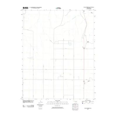
2010 Map of Flagg Springs
USGS Topo · Published 2010About this map
Wolf Mountain rises above the high plains of the Oklahoma Panhandle, providing a rare topographical marker in this predominantly flat agricultural landscape. The area is defined by a strictly surveyed section-line road system, including routes like N0250 Rd and E0160 Rd, which cut through the open country of Cimarron County. Water management is central to the land's utility, evidenced by the presence of Gaylor Number 1 Dam and the winding course of Flagg Springs Creek. The southern portion of the quadrangle is anchored by the Boise City Airport, a vital infrastructure point for this corner of the state where Oklahoma meets New Mexico and Colorado. The map reflects a modern era of rural infrastructure, where named section roads provide the primary navigation for remote ranching and farming operations.
Find a feature on this map
15 named features on this map. Tap any name to fly to it.
Don’t see what you’re looking for? This feature index may not catch every label — zoom into the map to look around manually.
Map Details
Editions of this 2010 Flagg Springs Map
This is the sole edition of this map. No revisions or reprints were ever made.
Other maps of this area

1954 · Dalhart
USGS Topo · 1:250,000

1958 · Dalhart
USGS Topo · 1:250,000

1962 · Dalhart
USGS Topo · 1:250,000

1968 · Autograph Cliff NW
USGS Topo · 1:24,000

1969 · Boise City
USGS Topo · 1:24,000

1969 · Boise City NW
USGS Topo · 1:24,000

1969 · Flagg Springs
USGS Topo · 1:24,000
1969 · Autograph Cliff
USGS Topo · 1:24,000
1969 · Razor Blade Mesa
USGS Topo · 1:24,000

1971 · Keyes SW
USGS Topo · 1:24,000