
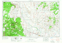
1954 Map of Flagstaff
USGS Topo · Published 1966About this map
San Francisco Mountain anchors this mid-century survey, with Humphreys Peak and Agassiz Peak rising above the surrounding Coconino National Forest. The landscape is a study in high-desert geography, transitioning from the volcanic peaks near Flagstaff to the vast plains of the Painted Desert and the carved path of Canyon Diablo. To the north and east, the Navajo Indian Reservation and Hopi Indian Reservation cover significant territory, revealing ancestral mesa settlements like Old Oraibi and Shongopovi. The era's transportation network is dominated by U.S. 66 and the Atchison Topeka and Santa Fe railroad, which parallel each other through Winslow and past the Navajo Ordnance Depot. These corridors provided the primary access for the emerging mid-century tourism industry at sites like Sunset Crater Natl Mon and Walnut Canyon Natl Mon.
Find a feature on this map
142 named features on this map. Tap any name to fly to it.
Don’t see what you’re looking for? This feature index may not catch every label — zoom into the map to look around manually.
Map Details
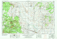
Editions of this 1954 Flagstaff Map
3 editions found
Other maps of this area

1883 · Marsh Pass
USGS Topo · 1:250,000

1883 · Tusayan
USGS Topo · 1:250,000

1886 · St Johns
USGS Topo · 1:250,000

1886 · Tusayan
USGS Topo · 1:250,000

1886 · Fort Defiance
USGS Topo · 1:250,000

1886 · San Francisco Mtns
USGS Topo · 1:250,000

1886 · Chino
USGS Topo · 1:250,000

1886 · Echo Cliffs
USGS Topo · 1:250,000

1886 · Holbrook
USGS Topo · 1:250,000

1886 · Kaibab
USGS Topo · 1:250,000