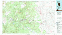
1982 Map of Flagstaff
USGS Topo · Published 1983About this map
San Francisco Mountain and the towering peaks of the Coconino National Forest dominate this early 1980s landscape. The city of Flagstaff serves as the central hub, where the Atchison Topeka and Santa Fe railroad and major highways converge. Scientific and military footprints are prominent, from the storied Lowell Observatory and U S Naval Observatory to the expansive Navajo Army Depot occupying the western flats of Government Prairie.
Find a feature on this map
53 named features on this map. Tap any name to fly to it.
Don’t see what you’re looking for? This feature index may not catch every label — zoom into the map to look around manually.
Map Details
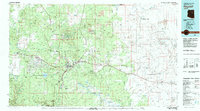
Editions of this 1982 Flagstaff Map
2 editions found
Other maps of this area

1883 · Tusayan
USGS Topo · 1:250,000

1886 · Tusayan
USGS Topo · 1:250,000

1886 · San Francisco Mtns
USGS Topo · 1:250,000

1886 · Chino
USGS Topo · 1:250,000

1886 · Holbrook
USGS Topo · 1:250,000

1887 · Verde
USGS Topo · 1:250,000

1887 · Prescott
USGS Topo · 1:250,000

1891 · San Francisco Mtns
USGS Topo · 1:250,000

1891 · Chino
USGS Topo · 1:250,000

1892 · Verde
USGS Topo · 1:250,000