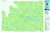
1986 Map of Flagstaff Lake
USGS Topo · Published 1986About this map
Flagstaff Lake and the Dead River basin dominate this mid-1980s look at the Maine North Woods, a landscape defined by timber production and the hydroelectric development that reshaped the valley. The map centers on the villages of Stratton and Eustis, which serve as the primary hubs for this region of Franklin County. Significant terrain features include the high peaks of Bigelow Mountain, Sugarloaf Mountain, and Mount Abraham, while the Appalachian National Scenic Trail winds across the ridgelines.
Find a feature on this map
309 named features on this map. Tap any name to fly to it.
Don’t see what you’re looking for? This feature index may not catch every label — zoom into the map to look around manually.
Map Details
Editions of this 1986 Flagstaff Lake Map
This is the sole edition of this map. No revisions or reprints were ever made.
Other maps of this area

1903 · Bingham
USGS Topo · 1:62,500

1904 · Anson
USGS Topo · 1:62,500

1905 · Bingham
USGS Topo · 1:62,500

1905 · The Forks
USGS Topo · 1:62,500

1907 · The Forks
USGS Topo · 1:62,500

1921 · Brassua Lake
USGS Topo · 1:62,500

1922 · Long Pond
USGS Topo · 1:62,500

1923 · Brassua Lake
USGS Topo · 1:62,500

1923 · Attean
USGS Topo · 1:62,500

1924 · Long Pond
USGS Topo · 1:62,500