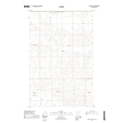
2020 Map of Flaherty Coulee
USGS Topo · Published 2020About this map
Flaherty Coulee and its neighboring drainage systems define this section of Daniels County, characterized by the deeply incised terrain typical of the northern Montana plains. This 2020 survey documents the watershed where Coal Cr and Butte Cr flow through the arid landscape, carving out significant features like Brockway Coulee and Martin Coulee. The map provides a detailed view of the rural infrastructure in this border region, showing the network of section-line roads and named routes that serve local ranching and agricultural interests. Prominent thoroughfares include Coal Creek Rd, Michel Rd, and Hammerberg Rd, which navigate the high-elevation flats and coulee floors. Located just south of the international boundary with the United States of America, this study preserves the modern configuration of townships and ranges, including t37n r44e, in a landscape where water and topography dictate the movement of commerce and transit.
Find a feature on this map
14 named features on this map. Tap any name to fly to it.
Don’t see what you’re looking for? This feature index may not catch every label — zoom into the map to look around manually.
Map Details
Editions of this 2020 Flaherty Coulee Map
This is the sole edition of this map. No revisions or reprints were ever made.
Other maps of this area

1954 · Wolf Point
USGS Topo · 1:250,000

1954 · Glasgow
USGS Topo · 1:250,000

1957 · Glasgow
USGS Topo · 1:250,000

1958 · Wolf Point
USGS Topo · 1:250,000

1958 · Glasgow
USGS Topo · 1:250,000

1973 · Horseshoe Basin
USGS Topo · 1:24,000

1973 · Brockway Spring
USGS Topo · 1:24,000

1973 · Peerless
USGS Topo · 1:24,000

1973 · Flaherty Coulee
USGS Topo · 1:24,000

1973 · Carbert
USGS Topo · 1:24,000