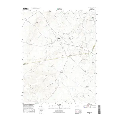
2016 Map of Flaherty
USGS Topo · Published 2016About this map
Flaherty serves as the central hub of this landscape, situated at the junction of numerous local routes including Woodland Rd and Tobacco Rd. The terrain is characterized by prominent rises such as Bee Knob Hill and Sand Ridge, which overlook a network of small family and community burial grounds scattered across the countryside. Genealogists can identify many specific sites, including Tarpley Cem, Arms Cem, and Martin Cem. To the northeast, the boundary of Fort Knox follows the winding path of Otter Creek, marking a transition from civilian farmland to military territory. The southern reaches are defined by natural drainage systems like Flippin Cr and Mays Run, while the community of Vine Grove appears on the eastern edge along the Meade and Hardin County line, demonstrating the persistent rural settlement patterns in this part of Kentucky.
Find a feature on this map
84 named features on this map. Tap any name to fly to it.
Don’t see what you’re looking for? This feature index may not catch every label — zoom into the map to look around manually.
Map Details
Editions of this 2016 Flaherty Map
This is the sole edition of this map. No revisions or reprints were ever made.
Other maps of this area

1932 · Big Clifty
USGS Topo · 1:62,500

1935 · Elizabethtown
USGS Topo · 1:48,000

1936 · Vine Grove
USGS Topo · 1:62,500

1938 · Elizabethtown
USGS Topo · 1:62,500

1941 · Ekron
USGS Topo · 1:62,500

1943 · Vine Grove
USGS Topo · 1:62,500

1946 · Rock Haven
USGS Topo · 1:24,000

1946 · Fort Knox
USGS Topo · 1:24,000

1946 · Vine Grove
USGS Topo · 1:24,000

1946 · Vine Grove
USGS Topo · 1:62,500