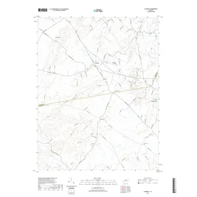
2019 Map of Flaherty
USGS Topo · Published 2019About this map
The settlement of Flaherty sits atop the high ground of Sand Ridge, serving as a central hub for this portion of the Kentucky landscape. For genealogists and local historians, this survey is particularly dense with family burial grounds, including the Yates Cem, Arms Cem, and Martin Cem found in the southern reaches. The boundary between Meade Co and Hardin Co cuts across the southeastern quadrant, where the terrain begins to slope toward the waters of Otter Creek. Prominent elevations like Bee Knob Hill and Fullove Hill break the horizon, while a network of rural roads such as Bee Knob Hill Rd and Rineville Big Springs Rd connect the scattered farmsteads and rural communities. This survey provides a clear view of the modern residential growth encroaching on the edge of Vine Grove near Brushy Fork.
Find a feature on this map
98 named features on this map. Tap any name to fly to it.
Don’t see what you’re looking for? This feature index may not catch every label — zoom into the map to look around manually.
Map Details
Editions of this 2019 Flaherty Map
This is the sole edition of this map. No revisions or reprints were ever made.
Other maps of this area

1932 · Big Clifty
USGS Topo · 1:62,500

1935 · Elizabethtown
USGS Topo · 1:48,000

1936 · Vine Grove
USGS Topo · 1:62,500

1938 · Elizabethtown
USGS Topo · 1:62,500

1941 · Ekron
USGS Topo · 1:62,500

1943 · Vine Grove
USGS Topo · 1:62,500

1946 · Rock Haven
USGS Topo · 1:24,000

1946 · Fort Knox
USGS Topo · 1:24,000

1946 · Vine Grove
USGS Topo · 1:24,000

1946 · Vine Grove
USGS Topo · 1:62,500