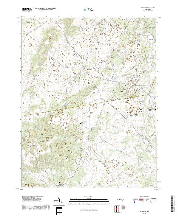
2022 Map of Flaherty
USGS Topo · Published 2022About this map
The rolling landscape of north-central Kentucky is defined here by the winding Otter Creek and its many tributaries, including Flippin Cr and Brushy Fork. The border between Meade and Hardin counties cuts across the center of the sheet, where rural life is anchored by family-named landmarks and long-established houses of worship. The terrain is marked by distinct rises like Bee Knob Hill and Fullove Hill, which separate the various drainage basins. A high density of cemeteries, such as Saint Martin Cem near Flaherty and Tarpley Cem further south, provides a valuable footprint for genealogical research. The road network, including the Rineyville Big Springs Rd, links these quiet residential pockets with larger local hubs like Vine Grove, reflecting a region where traditional land use and modern settlement patterns coexist along the ridges and hollows.
Find a feature on this map
100 named features on this map. Tap any name to fly to it.
Don’t see what you’re looking for? This feature index may not catch every label — zoom into the map to look around manually.
Map Details
Editions of this 2022 Flaherty Map
This is the sole edition of this map. No revisions or reprints were ever made.
Other maps of this area

1932 · Big Clifty
USGS Topo · 1:62,500

1935 · Elizabethtown
USGS Topo · 1:48,000

1936 · Vine Grove
USGS Topo · 1:62,500

1938 · Elizabethtown
USGS Topo · 1:62,500

1941 · Ekron
USGS Topo · 1:62,500

1943 · Vine Grove
USGS Topo · 1:62,500

1946 · Rock Haven
USGS Topo · 1:24,000

1946 · Fort Knox
USGS Topo · 1:24,000

1946 · Vine Grove
USGS Topo · 1:24,000

1946 · Vine Grove
USGS Topo · 1:62,500