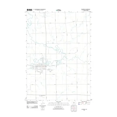
2012 Map of Flandreau
USGS Topo · Published 2012About this map
Flandreau serves as the focal point of this Moody County landscape, where the winding course of the Big Sioux River dictates the local geography. The settlement's grid is established north of the river, with arterial roads like E Pipestone Ave and W Broad Ave forming the town's core near the Po. To the southeast, a significant concentration of burial sites including Union Cem, Old Catholic Cem, and Catholic Cem provide essential data points for genealogical research.
Find a feature on this map
43 named features on this map. Tap any name to fly to it.
Don’t see what you’re looking for? This feature index may not catch every label — zoom into the map to look around manually.
Map Details
Editions of this 2012 Flandreau Map
This is the sole edition of this map. No revisions or reprints were ever made.
Other maps of this area

1953 · Watertown
USGS Topo · 1:250,000

1955 · Sioux Falls
USGS Topo · 1:250,000

1958 · Sioux Falls
USGS Topo · 1:250,000

1958 · Watertown
USGS Topo · 1:250,000

1963 · Trent
USGS Topo · 1:24,000

1964 · Flandreau SW
USGS Topo · 1:24,000

1964 · Flandreau NW
USGS Topo · 1:24,000

1967 · Elkton SW
USGS Topo · 1:24,000

1967 · Jasper NW
USGS Topo · 1:24,000

1967 · Elkton
USGS Topo · 1:24,000