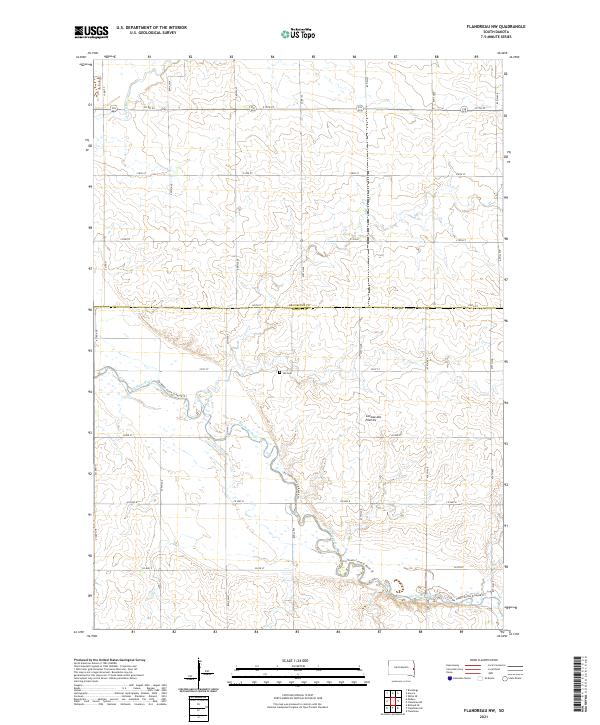
2021 Map of Flandreau NW
USGS Topo · Published 2021About this map
The Coteau des Prairies, a vast plateau of glacial deposits, defines the eastern landscape of South Dakota where the Big Sioux River carves a winding path through the prairie. In this section of Moody County, the river’s valley is a central corridor for recreation, now marked by the Jay Heath Canoe & Kayak Trl. Settlement patterns follow a rigid grid of section lines, though the land remains primarily agricultural. Significant for local family historians is the Yeo Cem, a small burial ground situated near the river's bend in the lower portion of the survey. The northern reaches are drained by Medary Cr, which joins the larger watershed amidst a network of county routes and section roads that have structured this rural territory since the initial land surveys.
Find a feature on this map
32 named features on this map. Tap any name to fly to it.
Don’t see what you’re looking for? This feature index may not catch every label — zoom into the map to look around manually.
Map Details
Editions of this 2021 Flandreau NW Map
This is the sole edition of this map. No revisions or reprints were ever made.
Other maps of this area

1953 · Watertown
USGS Topo · 1:250,000

1958 · Watertown
USGS Topo · 1:250,000

1964 · Brookings
USGS Topo · 1:24,000

1964 · Medary
USGS Topo · 1:24,000

1964 · Rutland SE
USGS Topo · 1:24,000

1964 · Flandreau SW
USGS Topo · 1:24,000

1964 · Flandreau NW
USGS Topo · 1:24,000

1964 · Aurora
USGS Topo · 1:24,000

1972 · Flandreau NE
USGS Topo · 1:24,000
1972 · White SE
USGS Topo · 1:24,000
Featured Places
- Trenton Township, SD
- Riverview Township, SD
- Spring Creek Township, SD
- Parnell Township, SD
- Brookings County, SD