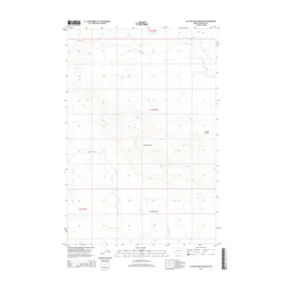
2014 Map of Flat Bottom Coulee NE
USGS Topo · Published 2014About this map
Badland Coulee dominates the central landscape of this Rosebud County region, illustrating a terrain defined by deep drainage patterns and seasonal watercourses. The northern portion of the quadrangle is traversed by Road 124, a primary artery through these high plains, while access to the interior reaches is facilitated by the BLM Access Rd. The drainage network is anchored by Little Porcupine Cr in the northeast and Coyote Cr to the north, which eventually give way to southern flows like Rattlesnake Cr. This map documents a sparsely settled Montana landscape where public land management and water access define the human footprint. The survey captures the intricate contouring of the coulees and the vast, open intervals between named creeks like Stellar Cr, providing a detailed record of the physical geography used by ranchers and land managers in the early 21st century.
Find a feature on this map
10 named features on this map. Tap any name to fly to it.
Don’t see what you’re looking for? This feature index may not catch every label — zoom into the map to look around manually.
Map Details
Editions of this 2014 Flat Bottom Coulee NE Map
This is the sole edition of this map. No revisions or reprints were ever made.
Other maps of this area

1954 · Forsyth
USGS Topo · 1:250,000

1957 · Forsyth
USGS Topo · 1:250,000

1958 · Forsyth
USGS Topo · 1:250,000

1965 · Needle Butte Reservoir
USGS Topo · 1:24,000

1965 · Vanstel
USGS Topo · 1:24,000

1965 · Stellar Lake
USGS Topo · 1:24,000

1969 · Rudie Coulee
USGS Topo · 1:24,000

1969 · Flat Bottom Coulee SW
USGS Topo · 1:24,000

1969 · Flat Bottom Coulee NE
USGS Topo · 1:24,000
1969 · Rough Creek SW
USGS Topo · 1:24,000