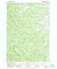
1984 Map of Flat Mountain
USGS Topo · Published 1984About this map
The Siuslaw National Forest and the City of Corvallis Municipal Watershed dominate the northwestern reaches of this 1984 survey, where steep terrain transitions from Griffith Ridge down to a network of winding drainages. The landscape is defined by its drainages, including Greasy Creek, Beaver Creek, and Henderson Creek, which served as the primary conduits for early rural development. Local history is anchored at the Powell Cem in the northeast, situated near the intersection of Peterson Road and Lewellyn Road.
Find a feature on this map
42 named features on this map. Tap any name to fly to it.
Don’t see what you’re looking for? This feature index may not catch every label — zoom into the map to look around manually.
Map Details
Editions of this 1984 Flat Mountain Map
This is the sole edition of this map. No revisions or reprints were ever made.
Other maps of this area

1911 · Monroe
USGS Topo · 1:31,680

1911 · Inavale
USGS Topo · 1:31,680

1913 · Philomath
USGS Topo · 1:31,680

1921 · Corvallis
USGS Topo · 1:62,500

1922 · Monroe
USGS Topo · 1:62,500

1939 · Marys Peak
USGS Topo · 1:62,500

1939 · Monroe
USGS Topo · 1:62,500

1942 · Marys Peak
USGS Topo · 1:62,500

1942 · Alsea
USGS Topo · 1:62,500

1942 · Monroe
USGS Topo · 1:62,500