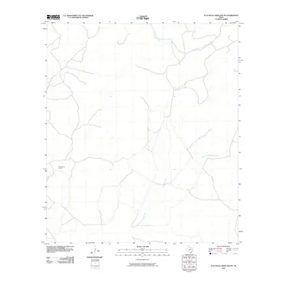
2010 Map of Flat Rock Creek South
USGS Topo · Published 2010About this map
Horn Ranch Airport anchors the western portion of this 2010 landscape in Kinney County, a region defined by the intricate dendritic drainage patterns of the Edwards Plateau. The map traces the intermittent paths of several major waterways, including Flat Rock Creek and the East Fork Sycamore Creek, which wind across the terrain toward the south. These drainage systems are central to the local geography, illustrating how seasonal water flow dictates the ranching and land-use patterns of the Texas borderlands. The presence of Cow Creek in the northwest corner further highlights the reliance on these natural draws in an otherwise arid environment. This survey provides a precise view of the rural infrastructure and natural hydrology that define the area's modern character.
Find a feature on this map
4 named features on this map. Tap any name to fly to it.
Don’t see what you’re looking for? This feature index may not catch every label — zoom into the map to look around manually.
Map Details
Editions of this 2010 Flat Rock Creek South Map
This is the sole edition of this map. No revisions or reprints were ever made.
Other maps of this area

1893 · Nueces
USGS Topo · 1:125,000

1896 · Nueces
USGS Topo · 1:125,000

1896 · Brackett
USGS Topo · 1:125,000

1897 · Brackett
USGS Topo · 1:125,000

1941 · Standart
USGS Topo · 1:62,500

1943 · Standart
USGS Topo · 1:62,500

1944 · Flat Rock
USGS Topo · 1:62,500

1944 · Brackettville
USGS Topo · 1:62,500

1944 · Indian Mountain
USGS Topo · 1:62,500

1958 · Del Rio
USGS Topo · 1:250,000