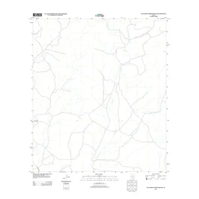
2013 Map of Flat Rock Creek South
USGS Topo · Published 2013About this map
The rural drainage network of Kinney County dominates this landscape, where the ephemeral waters of Flat Rock Cr and the E Fork Sycamore Cr carve their paths through the West Texas brush country. Settlement is minimal in this portion of the Edwards Plateau, characterized primarily by large-scale ranching operations and isolated infrastructure. The presence of the Horn Ranch Airport suggests the vital role of private aviation in managing these expansive properties, providing a necessary link between remote ranch lands and regional centers. Access to the area is anchored by Ranch Road 3008, which skirts the western edge of the quadrangle. In the northwest, Cow Cr contributes to the complex system of dry washes and seasonal streams that define the local topography, offering a clear view of the region's hydrologic patterns prior to modern development or significant land-use changes.
Find a feature on this map
5 named features on this map. Tap any name to fly to it.
Don’t see what you’re looking for? This feature index may not catch every label — zoom into the map to look around manually.
Map Details
Editions of this 2013 Flat Rock Creek South Map
This is the sole edition of this map. No revisions or reprints were ever made.
Other maps of this area

1893 · Nueces
USGS Topo · 1:125,000

1896 · Nueces
USGS Topo · 1:125,000

1896 · Brackett
USGS Topo · 1:125,000

1897 · Brackett
USGS Topo · 1:125,000

1941 · Standart
USGS Topo · 1:62,500

1943 · Standart
USGS Topo · 1:62,500

1944 · Flat Rock
USGS Topo · 1:62,500

1944 · Brackettville
USGS Topo · 1:62,500

1944 · Indian Mountain
USGS Topo · 1:62,500

1958 · Del Rio
USGS Topo · 1:250,000