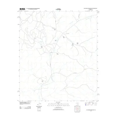
2012 Map of Flat Rock Draw SW
USGS Topo · Published 2012About this map
Devils River and the seasonal channel of the Dry Devils River dominate this West Texas landscape in Val Verde County. The map documents a territory defined by expansive ranching operations, including Phillips Ranch, Hunt Ranch, and Hunnicut Ranch, which are connected by a network of rural routes such as Co Rd 410 and Ranch Road 189. The terrain is characterized by complex drainage systems and topographic features like Rough Canyon and Flat Rock Draw. These canyons and draws, such as Pot Hole City Canyon and Ogels Road Canyon, reveal the erosive history of the Edwards Plateau. The sparse distribution of buildings and the concentration of named landmarks around ranches like Glasscock Ranch provide a clear view of the isolated, resource-dependent settlement patterns in this part of the state.
Find a feature on this map
16 named features on this map. Tap any name to fly to it.
Don’t see what you’re looking for? This feature index may not catch every label — zoom into the map to look around manually.
Map Details
Editions of this 2012 Flat Rock Draw SW Map
This is the sole edition of this map. No revisions or reprints were ever made.
Other maps of this area

1954 · Sonora
USGS Topo · 1:250,000

1958 · Sonora
USGS Topo · 1:250,000

1967 · Flat Rock Draw SE
USGS Topo · 1:24,000

1967 · Flat Rock Draw SW
USGS Topo · 1:24,000

1967 · Shafter Draw
USGS Topo · 1:24,000

1967 · Hudspeth Draw
USGS Topo · 1:24,000

1969 · Wild Horse Canyon
USGS Topo · 1:24,000

1970 · Juno
USGS Topo · 1:24,000

1970 · Brushy Draw
USGS Topo · 1:24,000

1973 · White Draw NW
USGS Topo · 1:24,000