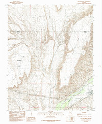
1985 Map of Flat Top Mesa
USGS Topo · Published 1985About this map
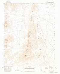
Bunkerville occupies the low-lying fertile ground along the south bank of the Virgin River in the mid-1980s, serving as a concentrated point of settlement amidst the arid high plateaus of the Nevada desert. This survey documents the critical irrigation infrastructure of the Virgin Valley, most notably the Bunkerville Ditch which traces the base of the bluffs to sustain local agriculture. The surrounding landscape is defined by the massive elevated landforms of Flat Top Mesa to the east and Mormon Mesa to the west, separated by the deep drainage of Toquop Wash. The boundary between Lincoln and Clark Counties crosses the northern portion of the sheet, where the terrain transitions from the river valley into dissected uplands and remote catchments like Sink Reservoir.
Find a feature on this map
9 named features on this map. Tap any name to fly to it.
Don’t see what you’re looking for? This feature index may not catch every label — zoom into the map to look around manually.
Map Details
Editions of this 1985 Flat Top Mesa Map
This is the sole edition of this map. No revisions or reprints were ever made.
Other maps of this area

1886 · Saint Thomas
USGS Topo · 1:250,000

1893 · Saint Thomas
USGS Topo · 1:250,000

1954 · Las Vegas
USGS Topo · 1:250,000

1957 · Las Vegas
USGS Topo · 1:250,000
1957 · Mesquite
USGS Topo · 1:62,500
1958 · Virgin Peak
USGS Topo · 1:62,500
1958 · Overton
USGS Topo · 1:62,500

1959 · Las Vegas
USGS Topo · 1:250,000

1962 · Las Vegas
USGS Topo · 1:250,000
1969 · Davidson Peak
USGS Topo · 1:24,000