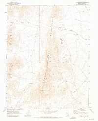
1969 Map of Davidson Peak
USGS Topo · Published 1972About this map
The East Mormon Mountains define this high-desert region of Lincoln County, stretching across a landscape marked by steep ridgelines and ephemeral drainage systems like the South Fork Toquop Wash. While the terrain is dominated by peaks like Davidson Peak, human activity is etched into the mountain flanks through a network of Jeep Trails and utility lines marked as Telephone.
Find a feature on this map
15 named features on this map. Tap any name to fly to it.
Don’t see what you’re looking for? This feature index may not catch every label — zoom into the map to look around manually.
Map Details
Editions of this 1969 Davidson Peak Map
2 editions found
Other maps of this area

1885 · Pioche
USGS Topo · 1:250,000

1886 · Saint Thomas
USGS Topo · 1:250,000

1886 · Pioche
USGS Topo · 1:250,000

1893 · Saint Thomas
USGS Topo · 1:250,000

1954 · Caliente
USGS Topo · 1:250,000

1954 · Las Vegas
USGS Topo · 1:250,000

1957 · Las Vegas
USGS Topo · 1:250,000

1957 · Mesquite
USGS Topo · 1:62,500

1959 · Caliente
USGS Topo · 1:250,000

1959 · Las Vegas
USGS Topo · 1:250,000