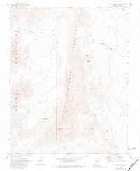
1969 Map of Davidson Peak
USGS Topo · Published 1983About this map
East Mormon Mountains dominate this high-desert landscape in southeastern Lincoln County, documented through a 1969 field check. The terrain is defined by dramatic elevation changes rising toward Davidson Peak and the high point known as The Summit. Water sources are scarce, appearing as seasonal drainage in the South Fork Toquop Wash and isolated points like Gourd Spring and Peach Spring.
Find a feature on this map
16 named features on this map. Tap any name to fly to it.
Don’t see what you’re looking for? This feature index may not catch every label — zoom into the map to look around manually.
Map Details
Editions of this 1969 Davidson Peak Map
2 editions found
Other maps of this area

1885 · Pioche
USGS Topo · 1:250,000

1886 · Saint Thomas
USGS Topo · 1:250,000

1886 · Pioche
USGS Topo · 1:250,000

1893 · Saint Thomas
USGS Topo · 1:250,000

1954 · Caliente
USGS Topo · 1:250,000

1954 · Las Vegas
USGS Topo · 1:250,000

1957 · Las Vegas
USGS Topo · 1:250,000

1957 · Mesquite
USGS Topo · 1:62,500

1959 · Caliente
USGS Topo · 1:250,000

1959 · Las Vegas
USGS Topo · 1:250,000