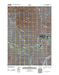
2011 Map of Flat Top Mountain
USGS Topo · Published 2011About this map
Flat Top Mountain rises above a landscape defined by seasonal watercourses and remote ranching infrastructure in Malheur County. This high-desert terrain is carved by the deep Bone Canyon and numerous drainages including Bone Creek, Drought Creek, and Wildcat Creek. The human presence in this corner of Oregon is marked by isolated outposts like Tudor Ranch and vital water sources such as Pothole Springs. Movement through the area relies on a network of unpaved tracks, notably N Fork Ryegrass Creek Rd and Crooked Creek Range Rd, which follow the natural contours of the basin and range geology. This map illustrates the vital relationship between topography and survival in the arid interior, where named springs and ranch roads are the primary landmarks.
Find a feature on this map
11 named features on this map. Tap any name to fly to it.
Don’t see what you’re looking for? This feature index may not catch every label — zoom into the map to look around manually.
Map Details
Editions of this 2011 Flat Top Mountain Map
This is the sole edition of this map. No revisions or reprints were ever made.
Other maps of this area

1955 · Jordan Valley
USGS Topo · 1:250,000

1955 · Adel
USGS Topo · 1:250,000

1957 · Adel
USGS Topo · 1:250,000

1957 · Jordan Valley
USGS Topo · 1:250,000

1958 · Adel
USGS Topo · 1:250,000

1958 · Jordan Valley
USGS Topo · 1:250,000

1962 · Adel
USGS Topo · 1:250,000

1972 · Palomino Hills
USGS Topo · 1:24,000
1972 · Burns Junction
USGS Topo · 1:24,000

1979 · Anderson Reservoir
USGS Topo · 1:24,000