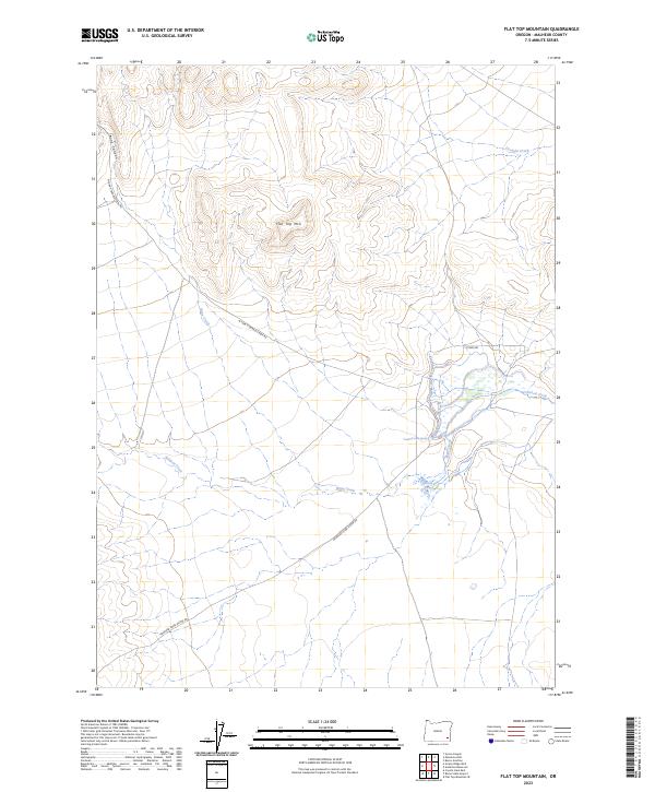
2023 Map of Flat Top Mountain
USGS Topo · Published 2023About this map
Flat Top Mtn dominates the high desert landscape of Malheur County in this contemporary survey, serving as a focal point for a network of intermittent watercourses and ranch access roads. The hydrology of the region is defined by the winding paths of Bone Creek and Crooked Creek, which converge amidst a series of wetlands and springs, including the notable Crooked Creek Spring. The terrain is marked by significant elevation changes, most visibly at Bone Canyon in the northwest, where the landscape transitions toward the drainage of Wildcat Creek.
Find a feature on this map
16 named features on this map. Tap any name to fly to it.
Don’t see what you’re looking for? This feature index may not catch every label — zoom into the map to look around manually.
Map Details
Editions of this 2023 Flat Top Mountain Map
This is the sole edition of this map. No revisions or reprints were ever made.
Other maps of this area

1955 · Jordan Valley
USGS Topo · 1:250,000

1955 · Adel
USGS Topo · 1:250,000

1957 · Adel
USGS Topo · 1:250,000

1957 · Jordan Valley
USGS Topo · 1:250,000

1958 · Adel
USGS Topo · 1:250,000

1958 · Jordan Valley
USGS Topo · 1:250,000

1962 · Adel
USGS Topo · 1:250,000

1972 · Palomino Hills
USGS Topo · 1:24,000
1972 · Burns Junction
USGS Topo · 1:24,000

1979 · Anderson Reservoir
USGS Topo · 1:24,000