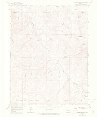
1963 Map of Flatiron Mountain
USGS Topo · Published 1967About this map
The White River National Forest and Grand Mesa National Forest meet in this high-altitude landscape of the Western Slope, surveyed in the early 1960s. The terrain is defined by the massive presence of Flatiron Mountain and Coal Ridge Creek, illustrating a wilderness area increasingly being utilized for energy extraction. Numerous Gas Wells and a Drill Hole are scattered across the ridges, particularly near Flagpole Mountain and Horse Park, while a network of pipelines cuts across the gulches. Despite this industrial encroachment, the area remains remote, serviced primarily by a Pack Trail and several jeep tracks. Water management is evident along the northern boundary through the Highline Ditch, while the Cayton Guard Station stands as a lonely administrative outpost monitoring the drainages of Cayton Gulch and Muddy Creek.
Find a feature on this map
41 named features on this map. Tap any name to fly to it.
Don’t see what you’re looking for? This feature index may not catch every label — zoom into the map to look around manually.
Map Details
Editions of this 1963 Flatiron Mountain Map
4 editions found
Other maps of this area

1957 · Leadville
USGS Topo · 1:250,000

1959 · Leadville
USGS Topo · 1:250,000

1960 · Leadville
USGS Topo · 1:250,000

1961 · Porter Mountain
USGS Topo · 1:24,000

1961 · Spruce Mountain
USGS Topo · 1:24,000

1962 · Leadville
USGS Topo · 1:250,000
1963 · Flatiron Mountain
USGS Topo · 1:24,000
1963 · Center Mountain
USGS Topo · 1:24,000
1963 · Hightower Mountain
USGS Topo · 1:24,000
1963 · Hunter Mesa
USGS Topo · 1:24,000