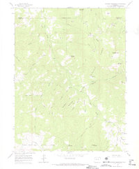
1963 Map of Flatiron Mountain
USGS Topo · Published 1967About this map
White River National Forest defines this high-altitude landscape along the border of Garfield Co and Mesa Co. The terrain is characterized by a dense network of gulches and peaks, where resource extraction and water management are the primary human imprints. Numerous Gas Wells and a Drill Hole are scattered across the northern sections, particularly near Coal Ridge Creek and Flatiron Mountain.
Find a feature on this map
37 named features on this map. Tap any name to fly to it.
Don’t see what you’re looking for? This feature index may not catch every label — zoom into the map to look around manually.
Map Details
Editions of this 1963 Flatiron Mountain Map
4 editions found
Other maps of this area

1957 · Leadville
USGS Topo · 1:250,000

1959 · Leadville
USGS Topo · 1:250,000

1960 · Leadville
USGS Topo · 1:250,000

1961 · Porter Mountain
USGS Topo · 1:24,000

1961 · Spruce Mountain
USGS Topo · 1:24,000

1962 · Leadville
USGS Topo · 1:250,000
1963 · Flatiron Mountain
USGS Topo · 1:24,000
1963 · Center Mountain
USGS Topo · 1:24,000
1963 · Hightower Mountain
USGS Topo · 1:24,000
1963 · Hunter Mesa
USGS Topo · 1:24,000