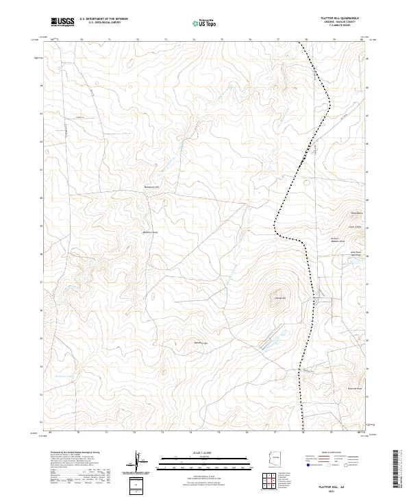
2021 Map of Flattop Hill
USGS Topo · Published 2021About this map
Flattop Hill and Monument Hill anchor this expanse of Navajo County, Arizona, where the high desert landscape is defined by a network of drainage channels and prominent elevations. The terrain is deeply etched by Washboard Wash and its eastern branch, E Washboard Wash, which run alongside topographic landmarks like Sheza Butte and the Lower Knolls. This survey details a sparse but vital infrastructure of local routes including Old Holbrook Rd, Reidhead Ave, and Oasis Trl.
Find a feature on this map
23 named features on this map. Tap any name to fly to it.
Don’t see what you’re looking for? This feature index may not catch every label — zoom into the map to look around manually.
Map Details
Editions of this 2021 Flattop Hill Map
This is the sole edition of this map. No revisions or reprints were ever made.
Other maps of this area

1886 · Holbrook
USGS Topo · 1:250,000

1893 · Holbrook
USGS Topo · 1:250,000

1954 · Holbrook
USGS Topo · 1:250,000

1955 · St. Joseph 2 SE
USGS Topo · 1:24,000

1955 · St. Joseph 1 SE
USGS Topo · 1:24,000

1955 · Joseph City
USGS Topo · 1:62,500
1955 · Holbrook
USGS Topo · 1:62,500

1957 · Holbrook
USGS Topo · 1:250,000

1958 · Holbrook
USGS Topo · 1:250,000

1960 · Holbrook
USGS Topo · 1:250,000