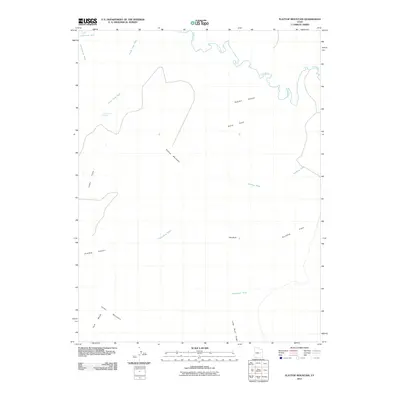
2011 Map of Flattop Mountain
USGS Topo · Published 2011About this map
Price River meanders across the northern reaches of this high desert landscape, carving through a series of canyons and gulches. The terrain is defined by significant elevation changes, from the prominent Flattop Mountain to the southern expanse of Cedar Mountain and Huff Bench. Water sources are vital markers in this arid region, with both Dripping Spring and Lucky Flats Spring appearing as critical landmarks for travelers and locals alike.
Find a feature on this map
17 named features on this map. Tap any name to fly to it.
Don’t see what you’re looking for? This feature index may not catch every label — zoom into the map to look around manually.
Map Details
Editions of this 2011 Flattop Mountain Map
This is the sole edition of this map. No revisions or reprints were ever made.
Other maps of this area

1886 · Price River
USGS Topo · 1:250,000

1896 · Price River
USGS Topo · 1:250,000

1948 · Woodside
USGS Topo · 1:62,500

1949 · Woodside
USGS Topo · 1:62,500

1950 · Woodside
USGS Topo · 1:62,500

1956 · Price
USGS Topo · 1:250,000

1960 · Price
USGS Topo · 1:250,000

1962 · Price
USGS Topo · 1:250,000
1969 · Dry Mesa
USGS Topo · 1:24,000

1969 · Olsen Reservoir
USGS Topo · 1:24,000