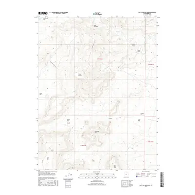
2017 Map of Flattop Mountain
USGS Topo · Published 2017About this map
Flattop Mountain rises as a central landmark in this high-desert landscape of Emery County, which is defined by a complex network of dry washes and canyons. The Price River cuts across the northern reaches, fed by drainages such as Lucky Flats Wash and Sulphur Canyon. To the south, topographic features like Cedar Mtn, Huff Bench, and The Door create a varied environment of ridges and flats. Of particular note is the Dinosaur Quarry & Flat Top trail or road that winds through the western terrain, pointing to the region's paleontological significance. The map also captures several water sources essential for survival in this arid territory, including Dripping Spring and Lucky Flats Spring, which would have been critical markers for early travelers and livestock operations alike.
Find a feature on this map
24 named features on this map. Tap any name to fly to it.
Don’t see what you’re looking for? This feature index may not catch every label — zoom into the map to look around manually.
Map Details
Editions of this 2017 Flattop Mountain Map
This is the sole edition of this map. No revisions or reprints were ever made.
Other maps of this area

1886 · Price River
USGS Topo · 1:250,000

1896 · Price River
USGS Topo · 1:250,000

1948 · Woodside
USGS Topo · 1:62,500

1949 · Woodside
USGS Topo · 1:62,500

1950 · Woodside
USGS Topo · 1:62,500

1956 · Price
USGS Topo · 1:250,000

1960 · Price
USGS Topo · 1:250,000

1962 · Price
USGS Topo · 1:250,000
1969 · Dry Mesa
USGS Topo · 1:24,000

1969 · Olsen Reservoir
USGS Topo · 1:24,000