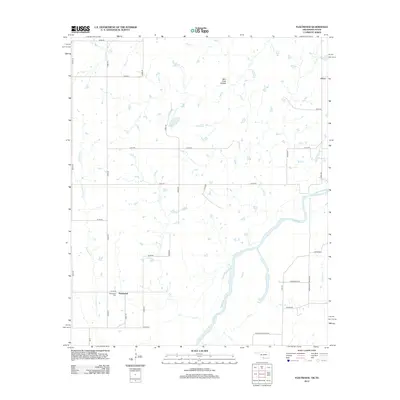
2012 Map of Fleetwood
USGS Topo · Published 2012About this map
The Red River forms a shifting natural boundary between Oklahoma and Texas, defining the southern reaches of this Jefferson County survey. The landscape is characterized by its complex drainage network, where Cat Cr, Red Cr, and Salt Cr carve through the terrain before meeting the main river channel. Local history is anchored by the small settlements of Fleetwood and Oscar, connected by a grid of rural routes including Red River Station Rd, which hints at the area's historical role as a river crossing point.
Find a feature on this map
37 named features on this map. Tap any name to fly to it.
Don’t see what you’re looking for? This feature index may not catch every label — zoom into the map to look around manually.
Map Details
Editions of this 2012 Fleetwood Map
This is the sole edition of this map. No revisions or reprints were ever made.
Other maps of this area

1901 · Addington
USGS Topo · 1:125,000

1905 · Montague
USGS Topo · 1:125,000

1954 · Sherman
USGS Topo · 1:250,000

1957 · Ardmore
USGS Topo · 1:250,000

1958 · Sherman
USGS Topo · 1:250,000

1962 · Ryan
USGS Topo · 1:62,500

1963 · Ardmore
USGS Topo · 1:250,000
1968 · Terral
USGS Topo · 1:24,000

1968 · Nocona
USGS Topo · 1:24,000

1968 · Fleetwood
USGS Topo · 1:24,000